Step 2-Specify Spatial Options
In this step you will specify the spatial options to be used
during the ModelBuilder process. The spatial options will determine the
placement and connectivity of the model elements. The fields available in this
step will vary depending on the data source type.
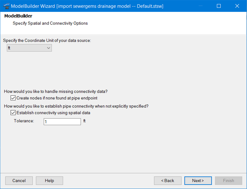
- Specify the Coordinate Unit of your data source (drop-down list)—This field allows you to specify the coordinate unit of the spatial data in your data source. The default unit is the unit used for coordinates.
- Create nodes if none found at pipe endpoint (check box)—When this box is checked, ModelBuilder will create a pressure junction at any pipe endpoint that: a) doesn’t have a connected node, and b) is not within the specified tolerance of an existing node. This field is only active when the Establish connectivity using spatial data box is checked. (This option is not available if the connection is bringing in only point type geometric data.)
- ModelBuilder will not create pipes unless a valid start/stop node exists. Choose this option if you know that there are nodes missing from your source data. If you expect your data to be complete, then leave this option off and if this situation is detected ModelBuilder will report errors for your review. For more information see Specifying Network Connectivity in ModelBuilder.
- Establish connectivity using spatial data (check box)—When this box is checked, ModelBuilder will connect pipes to nodes that fall within a specified tolerance of a pipe endpoint. (This option is available if the connection is bringing in only polyline type geometric data.) Use this option, when the data source does not explicitly name the nodes at the end of each pipe. For more information, see Specifying Network Connectivity in ModelBuilder.
- Tolerance (numeric field)—This field dictates how close a node must be to a pipe endpoint in order for connectivity to be established. The Tolerance field is only available when the Establish connectivity using spatial data box is checked. (This option is available if the connection is bringing in only polyline type geometric data.) Tolerances should be set as low as possible so that unintended connections are not made. If you are not sure what tolerance to use, try doing some test runs. Use the Network Review queries to evaluate the success of each trial import. Pipes will be connected to the closest node within the specified tolerance.
- The unit associated with the tolerance is dictated by the Specify the Coordinate Unit of your data source field. For more information, see Specifying Network Connectivity in ModelBuilder.